Glacier Bay Explorer
All Photos
Artist: Bill Eichenlaub

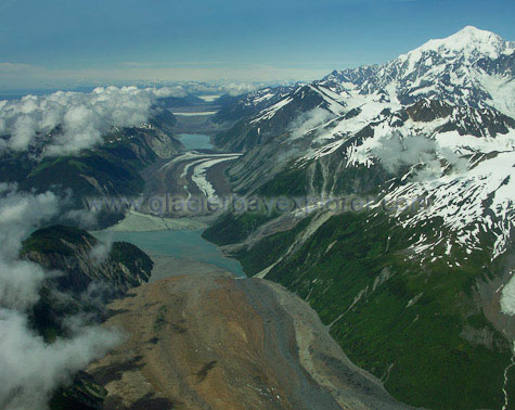
Desolation Valley – this is the active seam between North America and the Pacific crustal tectonic plates. Earthquakes are frequent and when you camp there you may well be woken in the night to the sound of falling rock. Below us is North Crillon Glacier covered in red and gray rock. The ice that carried the rock from the high mountains is barely visible. The view northwest along Desolation Valley crosses the head of Lituya Bay (at sea level) and the striped terminus of Lituya Glacier. Mt. Fairweather is the highest point on the right at 15,320 feet above sea level. From Lituya Bay to the summit of Mt. Fairweather is 16 miles as the raven flies.