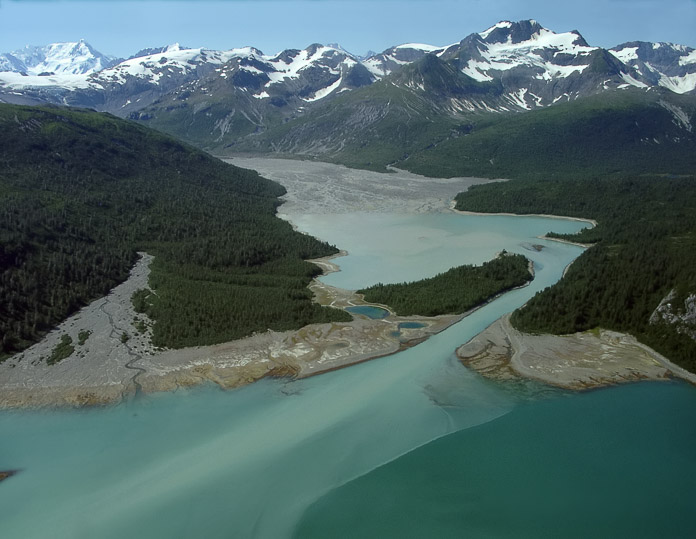
En 1928, la marina de los EE.UU. envió un avión de reconocimiento al sudeste de Alaska para que tomara fotografías aéreas. Esas fotos muestran que la mayor parte de la bahía que se aprecia en la mitad de esta imagen, no existía en ese entonces; se encontraba bajo la extensión helada del Hugh Miller Glacier (glaciar Hugh Miller), que hoy en día está replegado en la esquina de la izquierda.
In 1928 the U.S. Navy flew a survey plane throughout Southeast Alaska taking aerial photos. Those photos show that most of the bay shown in the middle of this image didn't exist back then – it was beneath the ice terminus of the Hugh Miller Glacier, which has now retreated back around the corner to the left. Photographer: Bill Eichenlaub