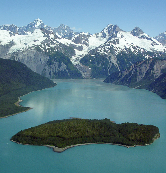
Lituya Bay(利图亚湾)有着神话般的名声,而且它也名副其实。这个名字来自Tlingit(特林吉特语)Ltu.aa或者“尖角里的湖”。照片里前面是Cenotaph Island(森诺塔福岛)。在1796年,La Perouse(拉裴罗斯,法国探险家)和他的从人在Lituya Bay(利图亚湾)呆了三个星期,将其称为Port des Francois(德福朗索瓦港)。
Lituya Bay (la bahía Lituya) tiene una reputación mítica y bien merecida. Su nombre proviene del tlingit “Ltu.aa”, o "lago dentro de la punta." En primer plano, vemos la isla Cenotafio (Cenotaph Island). En 1786, Laperouse y sus hombres se quedaron tres semanas en Lituya Bay (la bahía Lituya), y la llamaron “Port des Francois” (puerto de Franceses). Al fondo a la izquierda, está la pendiente en la que, en 1958, un terremoto provocó un enorme desprendimiento de tierra. Cuando ésta llegó al agua, generó una gigantesca ola de unos 524 m. de altura (1.720 pies) que inundó la cresta, hizo desaparecer la vegetación de la orilla, anegó partes de Cenotaph Island (la isla Cenotafio) y arrastró dos barcos mar adentro.
Lituya Bay is mythical in reputation and deservedly so. The name comes from the Tlingit Ltu.aa, or “lake inside the point.” In the foreground is Cenotaph Island. In 1786 LaPerouse and his men stayed in Lituya Bay for three weeks and called it Port des Francois.
In the background on the left is the slope where an earthquake caused a massive landslide in 1958. When the landslide hit the water it generated a giant wave (~1,720 ft high) that washed over the ridge, scoured the vegetation above the shore, washed over parts of Cenotaph Island and swept two boats out to sea. Photographer: Bill Eichenlaub